
Mexico. Melancholy, profoundly right and wrong, it embraces as it strangulates. Ana Castillo
A fuerza, ni los zapatos entran. You can’t force your shoes to fit.
Al mal paso, darle prisa. During bad times hurry up to a solution.
Barriga llena, corazón contento. Full stomach, happy heart.
Arrieros somos y en el camino andamos. Don’t criticize or judge others. We are all subject to problems and failings.
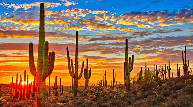
Mexico officially the United Mexican States (Estados Unidos Mexicanos) is a country in the southern portion of North America. It is bordered to the north by the United States; to the south and west by the Pacific Ocean; to the southeast by Guatemala, Belize, and the Caribbean Sea; and to the east by the Gulf of Mexico. Mexico is organized as a federation comprising 31 states and Mexico City, its capital and largest metropolis. Other major urban areas include Guadalajara, Monterrey, Puebla, Toluca, Tijuana, Ciudad Juárez, and León. Pre-Columbian Mexico traces its origins to 8,000 BC and is identified as one of six cradles of civilization; it was home to many advanced Mesoamerican civilizations, most notably the Maya and the Aztecs. In 1521, the Spanish Empire conquered and colonized the region from its base in Mexico City, establishing the colony of New Spain. The Catholic Church played an important role in spreading Christianity and the Spanish language, while also preserving some indigenous cultures. Native populations were heavily exploited to mine rich deposits of precious metals, which contributed to Spain’s status as a major world power for the next three centuries. Over time, a distinct Mexican identity formed, based on a fusion of indigenous and Europeans customs; this contributed to the successful Mexican War of Independence against Spain in 1821. Mexico’s early history as a nation state was marked by political and socioeconomic upheaval. The Texas Revolution and the Mexican–American War in the mid 19th century led to huge territorial losses to the United States. The newly instituted reforms that granted protection to indigenous communities, and curtailed the power of the military and the church, were enshrined in the Constitution of 1857. This triggered the War of the Reform and French intervention, which installed Maximilian Habsburg as emperor against resistance by republican forces led Benito Juárez. The following decades were marked by instability and dictatorship of Porfirio Díaz, who sought to modernize Mexico and restore order. The Porfiriato era ended with the decade-long Mexican Revolution in 1910, after which the victorious Constitutionalist faction drafted a new 1917 Constitution, which remains in effect to this day. The revolutionary generals ruled as a succession of presidents until the assassination of Alvaro Obregón in 1928, which led to the formation of the Institutional Revolutionary Party the following year, under which Mexico was a de facto one-party state until 2000. Mexico is a developing country. Its large economy and population, global cultural influence, and steady democratization make Mexico a regional and middle power; it is often identified as an emerging power but is considered a newly industrialized state by several analysts. However, the country continues to struggle with social inequalities, poverty and extensive crime; it ranks poorly on the Global Peace Index, due in large part to ongoing conflict between the government and drug trafficking syndicates that led to over 120,000 deaths since 2006.
Cancun
Cancún is a city in southeast Mexico on the northeast coast of the Yucatán Peninsula in the Mexican state of Quintana Roo. It is a significant tourist destination in Mexico and the seat of the municipality of Benito Juárez. The city is on the Caribbean Sea and is one of Mexico’s easternmost points. Cancún is just north of Mexico’s Caribbean coast resort band known as the Riviera Maya. In older English-language documents, the city’s name is sometimes spelled “Cancoon”, an attempt to convey the sound of the name.


Canon del Sumidero
Sumidero Canyon (Cañón del Sumidero) is a deep natural canyon located just north of the city of Chiapa de Corzo in the state of Chiapas, in southern Mexico. The canyon’s creation began around the same time as the Grand Canyon in the U.S. state of Arizona, by a crack in the area’s crust and subsequent erosion by the Grijalva River, which still runs through it. Sumidero Canyon has vertical walls which reach as high as 1,000 metres (3,300 ft), with the river turning up to 90 degrees during the 13-kilometre (8.1 mi) length of the narrow passage. The canyon is surrounded by the Sumidero Canyon National Park, a federally protected natural area of Mexico which extends for 21,789 hectares (53,840 acres) over four municipalities of the state of Chiapas. This park is administered by the National Commission of Protected Natural Areas (CONANP). Most of the vegetation in the park is low- to medium-height deciduous rainforest, with small areas of mixed pine-oak forest and grassland. At the north end of the canyon is the Chicoasén Dam and its artificial reservoir, one of several on the Grijalva River, which is important for water storage and the generation of hydroelectric power in the region.


Chichén Itzá
Chichen Itza was a large pre-Columbian city built by the Maya people of the Terminal Classic period. The archaeological site is located in Tinúm Municipality, Yucatán State, Mexico. Chichen Itza was a major focal point in the Northern Maya Lowlands from the Late Classic (c. AD 600–900) through the Terminal Classic (c. AD 800–900) and into the early portion of the Postclassic period (c. AD 900–1200). The site exhibits a multitude of architectural styles, reminiscent of styles seen in central Mexico and of the Puuc and Chenes styles of the Northern Maya lowlands. The presence of central Mexican styles was once thought to have been representative of direct migration or even conquest from central Mexico, but most contemporary interpretations view the presence of these non-Maya styles more as the result of cultural diffusion. Chichen Itza was one of the largest Maya cities and it was likely to have been one of the mythical great cities, or Tollans, referred to in later Mesoamerican literature. The city may have had the most diverse population in the Maya world, a factor that could have contributed to the variety of architectural styles at the site. The ruins of Chichen Itza are federal property, and the site’s stewardship is maintained by Mexico’s Instituto Nacional de Antropología e Historia (National Institute of Anthropology and History). The land under the monuments had been privately owned until 29 March 2010, when it was purchased by the state of Yucatán.


Merida
Mérida is the capital and largest city in Yucatan state in Mexico, as well as the largest city of the Yucatán Peninsula. The city is located in the northwest part of the state, about 35 kilometres (22 miles) off the coast of the Gulf of Mexico. The city is also the municipal seat of the Municipality of Mérida, which includes the city and the areas around it. The city, like much of the state, has heavy Mayan, Spanish, French, British, Lebanese and to a lesser extent Dutch influences. Mérida has the highest percentage of indigenous population within any large city in Mexico. The Maya are approximately 60% of the population.


Mexico city
Mexico City Ciudad de México, is the capital and largest city of Mexico and the most-populous city in North America. Mexico City is one of the most important cultural and financial centres in the world. It is located in the Valley of Mexico (Valle de México), a large valley in the high plateaus in the center of Mexico, at an altitude of 2,240 meters (7,350 ft). The city has 16 subdivisions, formerly known as boroughs. Mexico’s capital is both the oldest capital city in the Americas and one of two founded by indigenous people, the other being Quito, Ecuador. The city was originally built on an island of Lake Texcoco by the Aztecs in 1325 as Tenochtitlan, which was almost completely destroyed in the 1521 siege of Tenochtitlan and subsequently redesigned and rebuilt in accordance with the Spanish urban standards. In 1524, the municipality of Mexico City was established, known as México Tenochtitlán, and as of 1585, it was officially known as Ciudad de México (Mexico City). Mexico City was the political, administrative, and financial center of a major part of the Spanish colonial empire. After independence from Spain was achieved, the federal district was created in 1824. After years of demanding greater political autonomy, residents were finally given the right to elect both a head of government and the representatives of the unicameral Legislative Assembly by election in 1997. Ever since, left-wing parties (first the Party of the Democratic Revolution and later the National Regeneration Movement) have controlled both of them. The city has several progressive policies, such as abortion on demand, a limited form of euthanasia, no-fault divorce, and same-sex marriage. On 29 January 2016, it ceased to be the Federal District (Spanish: Distrito Federal or D.F.) and is now officially known as Ciudad de México (or CDMX), with a greater degree of autonomy. A clause in the Constitution of Mexico, however, prevents it from becoming a state within the Mexican federation, as it is the seat of power in the country, unless the capital of the country were to be relocated elsewhere.


Magdalena Carmen Frida Kahlo y Calderón 6 July 1907 – 13 July 1954 was a Mexican painter known for her many portraits, self-portraits, and works inspired by the nature and artifacts of Mexico. Inspired by the country’s popular culture, she employed a naïvefolk art style to explore questions of identity, postcolonialism, gender, class, and race in Mexican society. Her paintings often had strong autobiographical elements and mixed realism with fantasy. In addition to belonging to the post-revolutionary Mexicayotl movement, which sought to define a Mexican identity, Kahlo has been described as a surrealist or magical realist. La Casa Azul, Kahlo’s childhood home and residence from 1939 until her death in 1954

Day of the Dead is both a commemoration of death and a celebration of life!

Palenque
Palenque was a Maya city state in southern Mexico that flourished in the 7th century. The Palenque ruins date from ca. 226 BC to ca. 799 AD. After its decline, it was overgrown by the jungle of cedar, mahogany, and sapodilla trees, but has since been excavated and restored. It is located near the Usumacinta River in the Mexican state of Chiapas, about 130 km (81 mi) south of Ciudad del Carmen, 150 meters (490 ft) above sea level. It averages a humid 26 °C (79 °F) with roughly 2,160 millimeters (85 in) of rain a year. Palenque is a medium-sized site, smaller than Tikal, Chichen Itza, or Copán, but it contains some of the finest architecture, sculpture, roof comb and bas-relief carvings that the Mayas produced. Much of the history of Palenque has been reconstructed from reading the hieroglyphic inscriptions on the many monuments; historians now have a long sequence of the ruling dynasty of Palenque in the 5th century and extensive knowledge of the city-state’s rivalry with other states such as Calakmul and Toniná. The most famous ruler of Palenque was K’inich Janaab Pakal, or Pacal the Great, whose tomb has been found and excavated in the Temple of the Inscriptions. By 2005, the discovered area covered up to 2.5 km2 (1 sq mi), but it is estimated that less than 10% of the total area of the city is explored, leaving more than a thousand structures still covered by jungle.


Teotihuacan
Teotihuacan is an ancient Mesoamerican city located in a sub-valley of the Valley of Mexico, which is located in the State of Mexico, 40 kilometres (25 mi) northeast of modern-day Mexico City. Teotihuacan is known today as the site of many of the most architecturally significant Mesoamerican pyramids built in the pre-Columbian Americas. At its zenith, perhaps in the first half of the first millennium (1 CE to 500 CE), Teotihuacan was the largest city in the pre-Columbian Americas, with a population estimated at 125,000 or more, making it at least the sixth-largest city in the world during its epoch. After the collapse of Teotihuacan, central Mexico was dominated by the Toltecs of Tula until about 1150 CE. The city covered eight square miles; 80 to 90 percent of the total population of the valley resided in Teotihuacan. Apart from the pyramids, Teotihuacan is also anthropologically significant for its complex, multi-family residential compounds, the Avenue of the Dead, and its vibrant, well-preserved murals. Additionally, Teotihuacan exported fine obsidian tools that are found throughout Mesoamerica. The city is thought to have been established around 100 BCE, with major monuments continuously under construction until about 250 CE. The city may have lasted until sometime between the 7th and 8th centuries CE, but its major monuments were sacked and systematically burned around 550 CE. Teotihuacan began as a religious center in the Mexican Highlands around the first century CE. It became the largest and most populated center in the pre-Columbian Americas. Teotihuacan was home to multi-floor apartment compounds built to accommodate the large population.The term Teotihuacan (or Teotihuacano) is also used for the whole civilization and cultural complex associated with the site. Although it is a subject of debate whether Teotihuacan was the center of a state empire, its influence throughout Mesoamerica is well documented; evidence of Teotihuacano presence can be seen at numerous sites in Veracruz and the Maya region. The later Aztecs saw these magnificent ruins and claimed a common ancestry with the Teotihuacanos, modifying and adopting aspects of their culture. The ethnicity of the inhabitants of Teotihuacan is the subject of debate. Possible candidates are the Nahua, Otomi, or Totonac ethnic groups. Scholars have suggested that Teotihuacan was a multi-ethnic state since they find cultural aspects connected to the Maya as well as Oto-Pamean people. Pyramid of the Sun of Teotihuacan with first human establishment in the area dating back to 600 BC


Xochimilco
Xochimilco is one of the 16 mayoralities (Spanish: alcaldías) or boroughs within Mexico City. The borough is centered on the formerly independent city of Xochimilco, which was established on what was the southern shore of Lake Xochimilco in the precolonial period. Today, the borough consists of the eighteen “barrios”, or neighborhoods, of this city along with fourteen “pueblos”, or villages, that surround it, covering an area of 125 km2 (48 sq mi). The borough is in the southeastern part of the city and has an identity that is separate from the historic center of Mexico City, due to its historic separation from that city during most of its history. Xochimilco is best known for its canals, which are left from what was an extensive lake and canal system that connected most of the settlements of the Valley of Mexico. These canals, along with artificial islands called chinampas, attract tourists and other city residents to ride on colorful gondola-like boats called “trajineras” around the 170 km (110 mi) of canals. This canal and chinampa system, as a vestige of the area’s precolonial past, has made Xochimilco a World Heritage Site. In 1950, Paramahansa Yogananda, in his Autobiography of a Yogi, wrote that if there were a scenic beauty contest, Xochimilco would get the first prize. However, the impacts of colonization as well as severe environmental degradation of the canals and chinampas have brought that status into question.


